


Voting District 060014, Schenectady County, New York
About
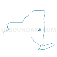
Outline

Summary
| Unique Area Identifier | 636667 |
| Name | Voting District 060014 |
| County | Schenectady County |
| State | New York |
| Area (square miles) | 0.52 |
| Land Area (square miles) | 0.51 |
| Water Area (square miles) | 0.01 |
| % of Land Area | 98.35 |
| % of Water Area | 1.65 |
| Latitude of the Internal Point | 42.77133260 |
| Longtitude of the Internal Point | -73.90285110 |
Maps


Graphs
Select a template below for downloading or customizing gragh for Voting District 060014, Schenectady County, New York


Neighbors
Neighoring Voting District (by Name) Neighboring Voting District on the Map
- Voting District 030003 030016, Schenectady County, NY
- Voting District 050013, Schenectady County, NY
- Voting District 050014, Schenectady County, NY
- Voting District 060046, Schenectady County, NY
- Voting District 060047, Schenectady County, NY
- Voting District 060048, Schenectady County, NY
- Voting District 060058, Albany County, NY
Top 10 Neighboring County Subdivision (by Population) Neighboring County Subdivision on the Map
- Colonie town, Albany County, NY (81,591)
- Schenectady city, Schenectady County, NY (66,135)
- Rotterdam town, Schenectady County, NY (29,094)
- Niskayuna town, Schenectady County, NY (21,781)
Top 10 Neighboring Place (by Population) Neighboring Place on the Map
Top 10 Neighboring Unified School District (by Population) Neighboring Unified School District on the Map
- Schenectady City School District, NY (66,116)
- South Colonie Central School District, NY (39,307)
- Rotterdam-Mohonasen Central School District, NY (20,336)
Top 10 Neighboring State Legislative District Lower Chamber (by Population) Neighboring State Legislative District Lower Chamber on the Map
- Assembly District 109, NY (139,831)
- Assembly District 110, NY (138,331)
- Assembly District 105, NY (137,005)
Top 10 Neighboring State Legislative District Upper Chamber (by Population) Neighboring State Legislative District Upper Chamber on the Map
Top 10 Neighboring 111th Congressional District (by Population) Neighboring 111th Congressional District on the Map
Top 10 Neighboring Census Tract (by Population) Neighboring Census Tract on the Map
- Census Tract 319, Schenectady County, NY (7,442)
- Census Tract 138.01, Albany County, NY (7,278)
- Census Tract 218, Schenectady County, NY (6,779)
- Census Tract 329.01, Schenectady County, NY (3,933)